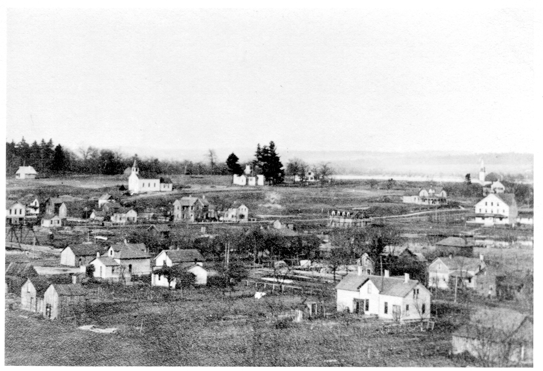
(Report by Jim) Filling in this last week lets me go back to all the archive photos I’ve scanned over the years. I scanned the thousand original Erhardt Peters negatives and photos that we helped secure for the museum. I scanned a stack for Marv Anderson and Frank Mead and Walter McCord when he was still with us. The photos today are from Frank’s collection. They pre-date the Erhardt Peters photos by a decade or so and I do not know who took them. The second photo is Leland taken toward the Northeast from Round Top, the large indian mound on South Lake Street. This was after the area was essentially clear-cut by the logging operations.
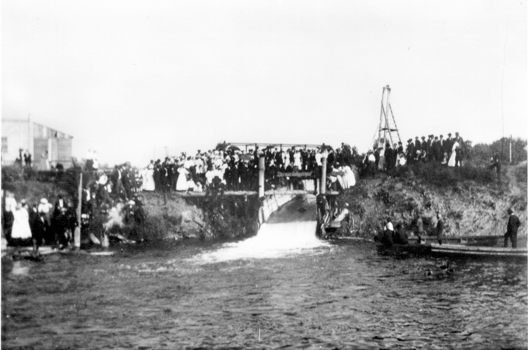
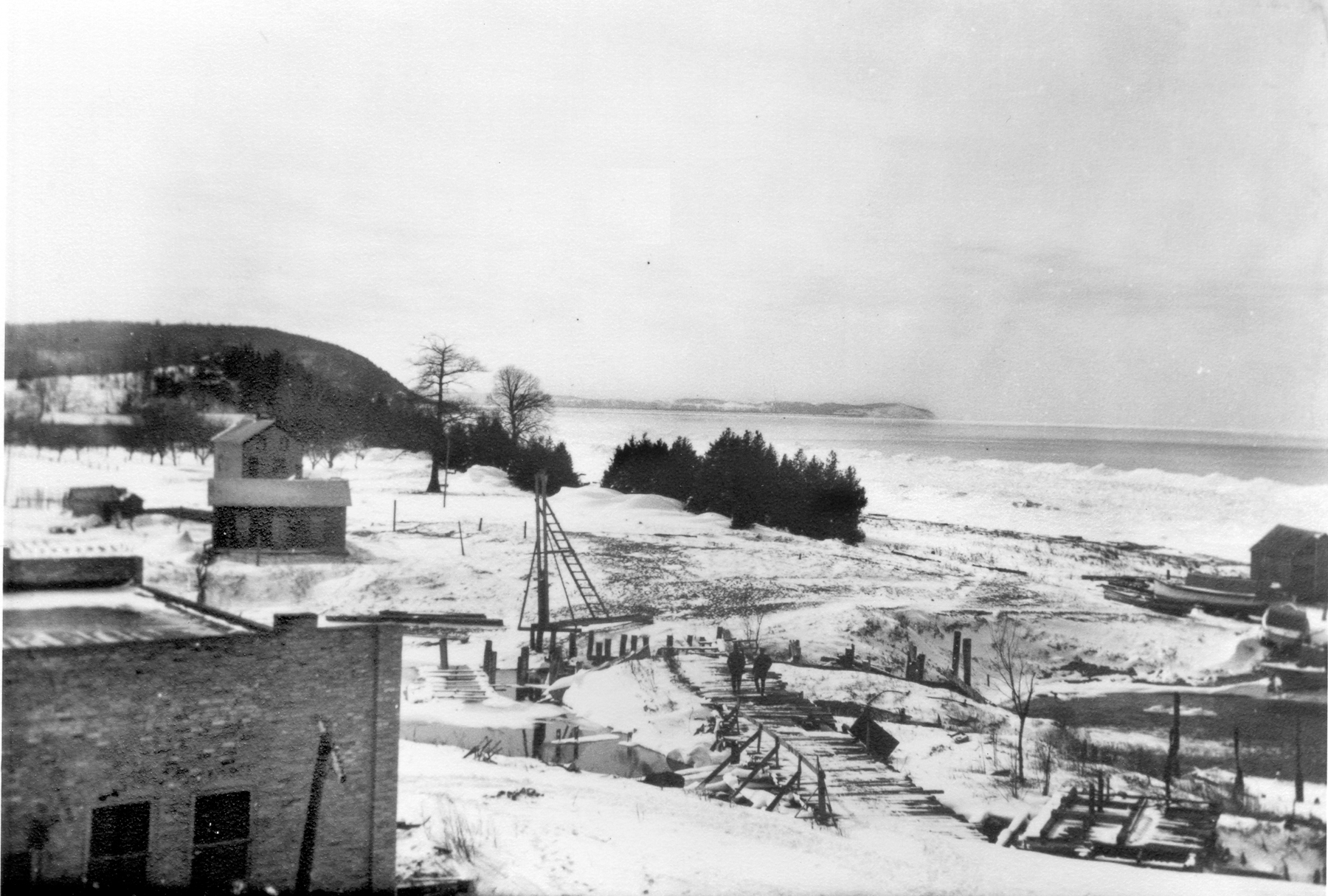
The first photo is not so hard to identify. You might recognize the building on the bottom left. I can’t be sure, but it might be the same building as, or at least the same location, where the Mercantile is now. That would make this the original dam that pre-dated the current Leland dam. As the photo below shows, the whole town assembled to celebrate what I can only guess is the opening. Many of them are standing on the wooden bridge that the two people are walking on in the first photo. This is the beginning (at least the expansion) of Lake Leelanau as we know it.
(My history is sketchy, so if anyone has anything to add or any corrections, I welcome them)


Great pictures. I love this stuff.
Wow! What great pictures!
I’m glad to hear Mr. Burnham is doing better.
Where is Round top now? or What is built on it?
If you drive down S. Lake Street, look toward the lake and you will see a steep hill with a house near the top. It looks out of place and long ago it had no trees on it (like the rest of the area)
Look towards which lake? Michigan or Leelanau, and how far down S Lake st? Sorry to sound dumb but I’d like to find it on googlemaps if thats possible.
Start at 475 s. Lake St, which is right near the mound. The photo is looking n.e. The church in the photo is the Methodist Church, which is still there
Thanks!!!
The built-environment is ephemeral; inevitably, progress and economics spell the doom for most of what we build. In the long run very little is preserved. For the rest all that remains are photographs. They become an invaluable historic record. Thanks for your stewardship of this photographic legacy.
BTW, I’m not condemning progress; just observing the inevitable result.